Tropical Storm Ivo Causes Land Warnings

tropical storm ivo, tropical storm warnings

While Tropical Storm Ivo is expected to weaken over several days, its large span (195 miles from the center of the storm) may affect coastal areas along the Baja Peninsula. As of Saturday, August 24, the storm was located 240 miles west of Cabo San Lucas, Mexico, and 360 miles south-southeast of Punta Eugenia, Mexico. The storm has maximum sustained winds of 45 miles per hour, and is moving north-northwest at 12 miles per hour. An advisory...

Read More
Tropical Storm Ivo

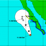
Tropical Depression Nine-E has strengthened into Tropical Storm Ivo earlier Friday morning, August 23, becoming the ninth named tropical storm of the eastern Pacific season. The storm is currently located 330 miles south-southwest of Cabo San Lucas, Mexico. Ivo has reached maximum sustained winds 40 miles per hour with gradual strengthening expected within the next 3 days but is not expected to strengthen enough to become a hurricane. The storm...

Read More

Erin Becomes a Post Tropical Cyclone

post tropical cyclone erin

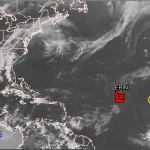
Tropical Storm Erin has decreased in strength once again to become a Post-Tropical Cyclone by Sunday, August 18. The storm is currently located west northwest of the Cape Verde Islands, decreasing in wind speed to 35 miles per hour. Erin, now a remnant low, is moving due west at 8 miles per hour, with possible shifting to a south of west motion over the next 48 hours. There are still no land warnings or watches in effect, as the storm is not...

Read More

Erin Strengthens To A Tropical Storm Again

tropical storm erin warning cone

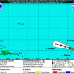
After weakening to a tropical depression, Erin has reignited to a tropical storm today, August 17. The storm is expected to weaken over the next few days, possibly becoming a tropical depression as early as Sunday, August 18. Currently the storm is located 920 miles west northwest of the Cape Verde Islands, reaching maximum sustained winds of 40 miles per hour. Tropical Storm Erin is moving at 13 miles per hour in a northwest direction, however...

Read More

Erin Weakens to Tropical Depression Status

tropical depression erin

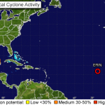
Earlier Friday, August 16, Erin decreased from a tropical depression to a tropical depression. Currently the storm is located 625 miles west of the Cape Verde Islands. Tropical Depression Erin has reached maximum sustained winds of 35 miles per hour, and is moving west northwest at 17 miles per hour. Currently there are no land warnings in effect, as the storm is still a great distance from any coast. The storm is expected to decrease in forward...

Read More

Tropical Storm Erin

A new tropical storm has formed near the Cape Verde Islands strengthening overnight from tropical depression status. A tropical storm warning had been placed on the southern Cape Verde Islands of Maio, Santiago, Fogo and Brava, meaning that tropical storm conditions were expected in this area within the next 12 hours, however that warning has been discontinued as the storm passes the islands. Currently the storm is located 115 miles west...

Read More