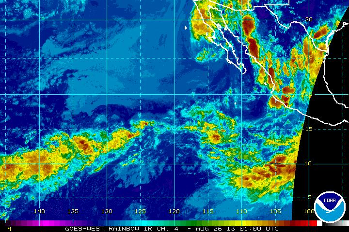
After becoming a Tropical Depression over Saturday night into early Sunday morning, Ivo has now become a remnant low and has deteriorated into a Post-Tropical Cyclone.
Currently the storm is located 190 miles west-northwest of Cabo San Lazaro, Mexico and 145 miles south of Punta Eugenia, Mexico, and has reached maximum sustained winds of 30 miles per hour. Ivo is moving north-northwest at 8 miles per hour, with all tropical storm watches and warnings lifted off of coastal cities.
The storm is expected to continue moving in this direction at its current speed, but will slow down to almost a standpoint on Monday, August 26. Weakening is expected to continue through mid-week. High amounts of rainfall is still expected from Ivo along the central and northern areas of the Baja California Peninsula, producing 1 to 3 inches of rain with some areas getting as much as 5 inches of rain. Some of this rainfall is predicted to expand into the southwestern U.S. over the next 48 hours, possibly increasing chances of flash flooding.
