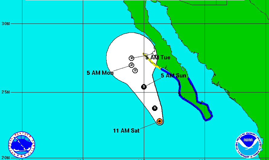
While Tropical Storm Ivo is expected to weaken over several days, its large span (195 miles from the center of the storm) may affect coastal areas along the Baja Peninsula. As of Saturday, August 24, the storm was located 240 miles west of Cabo San Lucas, Mexico, and 360 miles south-southeast of Punta Eugenia, Mexico.
The storm has maximum sustained winds of 45 miles per hour, and is moving north-northwest at 12 miles per hour. An advisory placed on Friday, August 23, maintained into the weekend, calling for a tropical storm warning for the Pacific coast of the Baja Peninsula from Punta Abreojos to Cabo San Lucas, and for the Gulf of California coast from Loreto to Cabo San Lucas.
A tropical storm watch has been placed on the Pacific coast of the Baja California Peninsula to the north of Punta Abreojos to Punta Eugenia.
Tropical storm weather is already occurring over the southern part of the Baja Peninsula and is only expected to expand northward. Ivo is forecasted to produce 1 to 3 inches, with some areas receiving as much as 5 inches of rain water. Surf swells are expected to expand from the southern point of the Baja California Peninsula northward, and may cause dangerous surf situations, as well as extreme rip current conditions.
Over the weekend the storm is expected to decrease in forward speed, however stay on its current path, as the center of the storm shifts parallel to the west coast of the Baja Peninsula. The storm is showing signs of weakening already, as thunderstorm activity has subsided, and is only expected to weaken further through Monday, August 26.
Stay updated with the latest information about Tropical Storm Ivo at www.national-hurricane-center.org.
